Reality capture

How reality capture can streamline construction projects

Learn about reality capture, the process of taking measurements and images of a physical location to represent it in a 3D model.


Image courtesy of ATFF

A 3D scan of the San Francesco alter in the 3,000-year-old medieval city of Volterra, Italy.
Reality capture technologies created this scan of the San Francesco altar in the medieval city of Volterra, Italy.

What is reality capture technology?

Reality capture is the technological process of acquiring data intended for use in re-creating a space or construction project in a digital 3D format for the purposes of establishing existing conditions, planning, quality assurance, or concepting changes.

A rendering shows an elevated highway under construction.
To model this elevated highway in Mexico, ICAbim used Autodesk ReCap and Navisworks to consolidate existing conditions with construction planning. Image courtesy of ICAbim.

How has reality capture software revolutionized design and documentation?

3D reality capture has roots in the simpler process of surveying, which involves recording a construction site’s measurements and data. As other modern spatial plotting techniques such as LIDAR/point clouds, photogrammetry, and ultrasonic became more widespread, architects and construction firms realized they could contribute to the physical representation of a project in digital form and augment 2D plans and elevations on paper.

Today, any combination of mixed-reality capture technologies can be used to create a faithfully accurate 3D digital model of an aspect of the built world. Combined with real-time inputs from third-party data sources about usage patterns and performance, reality capture software can serve as the linchpin of building information modeling (BIM), which represents a project’s progress in real time.

An engineer uses a scanning device to measure a construction site.
Reality capture integrates traditional techniques, such as site scanning.

Reality capture versus traditional site-capture methods

Reality capture doesn’t replace traditional techniques but rather provides for their consolidation and integration as digital data. Techniques that preceded 3D reality capture are suited to specific applications. Traditional surveying usually measures ground area rather than height or shape; LIDAR scanning captures very detailed shape and distance information but without color or material properties; and photogrammetry analyzes surfaces’ response to natural light from photographic data of an object or site, but isn’t as precise.

Reality capture software can combine the strengths of each method to create a digital model with an extremely accurate representation of distance, shape, material finish, and many other metrics. It can be an invaluable cost- and time-saving tool because any changes, ideas, or interrogation of usage can be executed in test runs that don’t affect the physical project.

Benefits of reality capture software

A digital model of a project built using reality capture technologies offers a host of cost, time, and efficiency benefits.

Cost control

A digital model of a project is a low-cost resource that provides more accurate measurements and metrics of all the necessary material procurement and allocation at every stage of construction. It takes the guesswork out of material purchases and prevents overruns and waste. Some insurers are even offering lower premiums for projects that incorporate an approved digital model, recognizing that reality capture software minimizes project risk.

Easy collaboration

Because a 3D model is digital, it’s shareable anywhere project stakeholders have an internet connection, letting them complete steps specific to their tasks from any location. Authorities can approve proposals, builders and contractors can provide more accurate estimates of costs and provisioning, and architects can make adjustments.

Low-cost ideation

If you’re renovating an existing building or preserving a historic site, records and plans for the original construction might be old, out of date, not up to modern standards, or not exist at all. Reality capture can be an efficient, cost-effective method for creating a digital representation of the structure. Once you have that, there are no costs to remove, rebuild, move, or reimagine the material or properties of a project when changes are performed on a digital model as a proof of concept.

More precise documentation

Measurements taken for a specific construction or design domain—even if transposed into a digital form—might not be easily translatable for other stakeholders. Reality capture software can enable the creation of a more accurate and up-to-date single source of truth, with all metrics maintained in easily shareable formats.

A safer workspace

The 3D model created during reality capture contains more accurate information about the physical properties of the project. Safety systems can use the data in this model to calculate risks and report on performance with just a few clicks, especially when considering changes.

Maintenance

Infrastructure projects such as utilities or factories are complex areas of construction that must be understood for their functionality more than their aesthetics. A clear picture of objects in space and the workflows within them is critical for infrastructure maintenance, refurbishment, or the integration of new technologies. Digital models created with the aid of reality capture technology let stakeholders investigate the site from every angle and perspective.

Autodesk reality capture software

Reality capture and 3D scanning software and services


Geospatial and engineering BIM platform for planning, design, and analysis


Civil engineering design and construction documentation


Plan, design, construct, and manage buildings with powerful tools for Building Information Modeling.


Examples of reality capture in the built world

An engineer perched on a pipe-like structure in a river surveys a dangerous industrial site.

ATFF

Where humans fear to tread

This French reality capture company focuses on dangerous, restricted or impossible-to-reach environments such as nuclear sites, autonomous industrial utilities, and military installations. Using stationary laser scanners (LIDAR), drone footage, and scanners attached to a car or backpack, ATFF collects comprehensive data for a low cost, letting clients or stakeholders filter out whatever they don’t need.

Image courtesy of ATFF

A train passes through a station in the Istanbul Metro.

Metro Istanbul

A virtual network

Istanbul’s 241 km rail network needs frequent maintenance and expansion to maintain an efficient, affordable service. The city’s transit authority created digital twins for new construction but stations built before 2015 had no digital models, so each addition to existing infrastructure requires comprehensive reality capture to represent stations or lines in digital models.

A digital representation of a water treatment room depicts many layered building systems.

Turner Construction

Putting reality capture through the paces

For a $600 million building project, a major German construction firm put reality capture to the test. The company presented its findings at Autodesk University in 2019, covering customer expectations, the limitations and opportunities inherent in the methodology, and the ROI it ultimately represented.

Reality capture resources

When dealing with the performance, maintenance, or updating of an existing structure, the best way to plan changes starts with reality capture. This video explains the basics.

This e-book explains how reality capture can help make starting a new construction project faster, more accurate, more collaborative, and easier to manage.

Learn how reality capture can augment a BIM methodology to smooth the coordination workflows at every stage of the project, taking into account everything from materials to local street shutdowns.

Reality capture can give construction projects innumerable workflow boosts, but it isn’t free and it’s not a cure-all. This Autodesk University session is all about planning a reality capture effort for maximum ROI.

Learn how using Autodesk’s ReCap Pro in Autodesk Construction Cloud offers wide-ranging benefits, including speeding up projects, improving data sharing and accuracy, cutting costs, and paving the way for more automation and AI-enhanced workflows.

Check out the product roadmap for Autodesk’s reality capture software and offer your feedback on the prioritization of planned and proposed features.


Frequently asked questions (FAQ) about reality capture

What is reality capture?

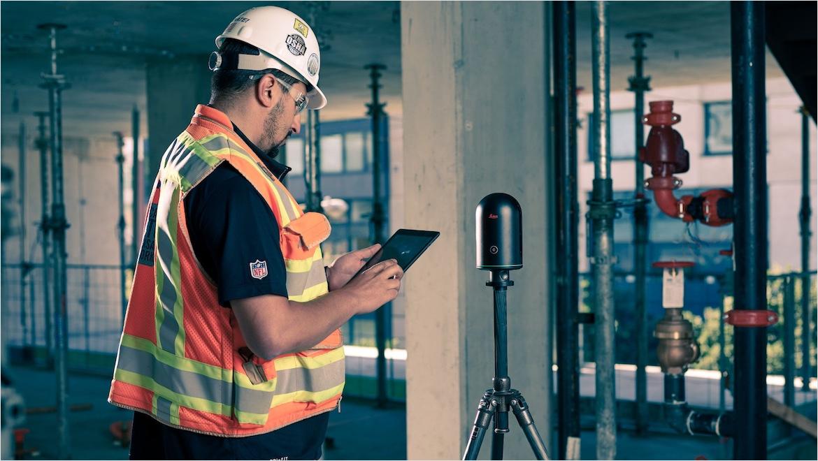
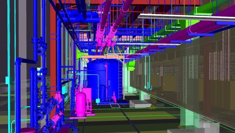
Reality capture is the process of collecting information about a physical location or space that can be recreated digitally. The system can then build a more accurate digital representation of the area and distribute it for action, editing, manipulation, or viewing by any stakeholder involved in the project, from any location.


Changes are then maintained in a single digital model so subsequent steps are based on a single source of truth, representing an up-to-the-minute version of the project.

How does reality capture work?

Reality capture takes readings using distance-based measurements from technologies such as radar, LIDAR, light-based photography, measurements taken from photogrammetry, or a combination of these methods. The data is then collated and synthesized by reality capture software, which builds a digital representation containing information including more precise distance measurements, true-to-life color, and more accurate representations of surface properties.

What are the benefits of reality capture?

The most important benefit of reality capture is that every stakeholder involved in the project can access the digital model resulting from reality capture and extract information or make changes. This approach saves money in data management and distribution. It also saves time, because anyone involved can gain access and work concurrently, and stakeholders can view and change the model remotely without having to travel to the site.

What reality capture software is available and how much does it cost?

ReCap Pro and Infraworks are Autodesk’s reality capture software solutions. A single-license ReCap Pro subscription is $390 per year or $1,170 for three years. A single-license Infraworks subscription is $2,090 for one year or $6,270 for three years.

Who uses reality capture software?

Reality capture software is used by architects, surveyors, land management consultants, materials providers, regulatory and approvals bodies, and construction firms.

What is reality capture technology used for?

When a space, building, or environment is set to be rebuilt or altered, reality capture is used to recreate it in a digital form to make the design and ideation phase easier, cheaper, and more collaborative among stakeholders.

See more FAQ